


2025 is shaping up to be one of the most geopolitically volatile years in recent memory. Alliances are shifting, old rivalries are intensifying, and new fault lines are emerging. Here’s a breakdown of key alliances and enmities based on current global conflicts and diplomatic alignments:
🌍 Major Alliances in 2025
| Alliance | Key Members | Purpose / Focus |
|---|---|---|
| NATO | US, UK, France, Germany, Poland, etc. | Collective defense, especially against Russian aggression in Ukraine |
| BRICS+ | Brazil, Russia, India, China, South Africa + Egypt, UAE, Iran | Economic cooperation, multipolar world order, counterbalance to Western dominance |
| Quad | US, India, Japan, Australia | Indo-Pacific security, countering China’s influence |
| EU | France, Germany, Italy, Spain, etc. | Political and economic union, support for Ukraine, sanctions on Russia |
| Israel–US–Gulf States (informal) | Israel, US, UAE, Bahrain, Saudi Arabia (partial) | Countering Iran, intelligence sharing, regional security |
| Russia–Iran–North Korea (strategic) | Russia, Iran, North Korea | Arms cooperation, anti-Western alignment, cyber and military support |
🔥 Active Conflicts & Rivalries
| Region | Conflict | Countries Involved | Status |
|---|---|---|---|
| Ukraine War | Russia vs Ukraine | Russia vs Ukraine (backed by NATO) | Ongoing, high casualties, no peace in sight |
| Middle East | Israel vs Hamas & Hezbollah | Israel vs Gaza (Hamas), Lebanon (Hezbollah), Iran | Escalating airstrikes, civilian toll rising |
| Taiwan Strait | China vs Taiwan | China vs Taiwan (US support for Taiwan) | Tense standoff, frequent military drills |
| India–Pakistan Skirmishes | Kashmir border | India vs Pakistan | Brief conflict in May 2025, tensions remain |
| Sudan Civil War | Government vs RSF | Internal conflict, regional spillover | Humanitarian crisis, no resolution |
| Eastern DRC | Government vs rebel groups | Congo vs M23 and others | Escalating violence, displacement |
⚔️ Notable Enmities
- Russia vs NATO/EU: Deepening hostility over Ukraine, cyberattacks, and sanctions.
- Iran vs Israel & US: Direct missile exchanges, proxy warfare in Lebanon and Gaza.
- China vs US/Japan/Philippines: South China Sea and Taiwan tensions.
- North Korea vs South Korea/US: Continued missile tests, nuclear threats.
- Pakistan vs India: Kashmir remains a flashpoint despite brief ceasefires.
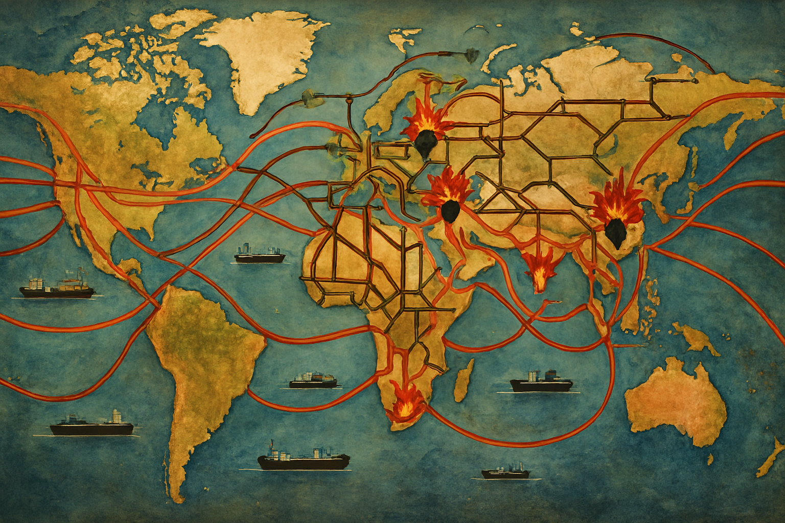
Trade Relationships (Import/Export Intensity):
- Thick crimson arcs for the heaviest trade flows (China–US, EU–China, US–EU, India–Middle East, ASEAN–China).
- Medium orange arcs for secondary but significant flows (Brazil–China, Africa–EU, Australia–Asia).
- Thin gold arcs for emerging trade corridors (Central Asia–Middle East, Africa–India, Latin America–Africa).
- Arc thickness proportional to trade volume; subtle arrowheads to indicate direction dominance.
Pipelines:
- Deep brown solid lines for oil pipelines.
- Dark green dashed lines for gas pipelines.
- Major corridors:
- Russia–Europe (reduced flow, annotated with “sanctions impact”)
- Central Asia–China
- Middle East–Europe/Asia
- North America domestic network
- East Africa–Asia LNG routes
Shipping Lanes & Ships:
- Stylized cargo ships with black hulls and white superstructures along:
- Strait of Malacca
- Suez Canal
- Panama Canal
- Cape of Good Hope
- Arctic Northern Sea Route (seasonal)
- Lane thickness tied to tonnage moved.
Wars & Conflicts (2025):
- Red explosion icons for active war zones:
- Eastern Europe (Ukraine–Russia front)
- Middle East (Israel–Gaza–Lebanon tensions, Yemen conflict)
- East Africa (Sudan civil war, Horn of Africa instability)
- Southeast Asia (South China Sea militarization)
- Amber warning triangles for high-tension zones: Taiwan Strait, Korean Peninsula, Sahel region.
🗂 Suggested Legend Layout
| Symbol / Color | Meaning | Example |
|---|---|---|
| Thick Crimson Arc | Top-tier trade flow | China–US |
| Medium Orange Arc | Secondary trade flow | Brazil–China |
| Thin Gold Arc | Emerging trade | Africa–India |
| Brown Solid Line | Oil pipeline | Druzhba Pipeline |
| Green Dashed Line | Gas pipeline | Power of Siberia |
| 🚢 Ship Icon | Major shipping lane | Suez Canal |
| 💥 Red Explosion | Active war zone | Eastern Ukraine |
| ⚠️ Amber Triangle | High tension | Taiwan Strait |
